|
Alaska Trip 2006
Week 3
Day 16
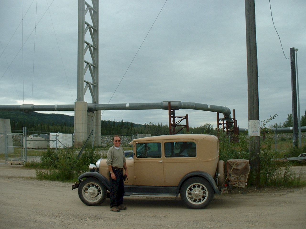
Sunday July 2, we drove 358 miles from Big Delta N64 07.534 W145 42.122 to Coldfoot camp N67 15.064 W150 10.553 which is north of the Arctic Circle. Thirty years ago I worked here in Delta on the oil pipeline project. It felt good to see it all again.
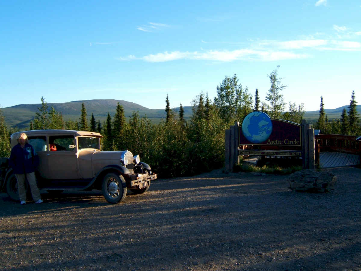
We are now at the Arctic Circle. It is almost midnight, the sun is low and in the north, this makes for eerie shadows. There were a lot of mosquitoes here. It was after midnight when we arrived at Coldfoot Camp. The Hotel room was in a thirty year old pipeline construction camp trailer. We were tired and went right to sleep.
Day 17
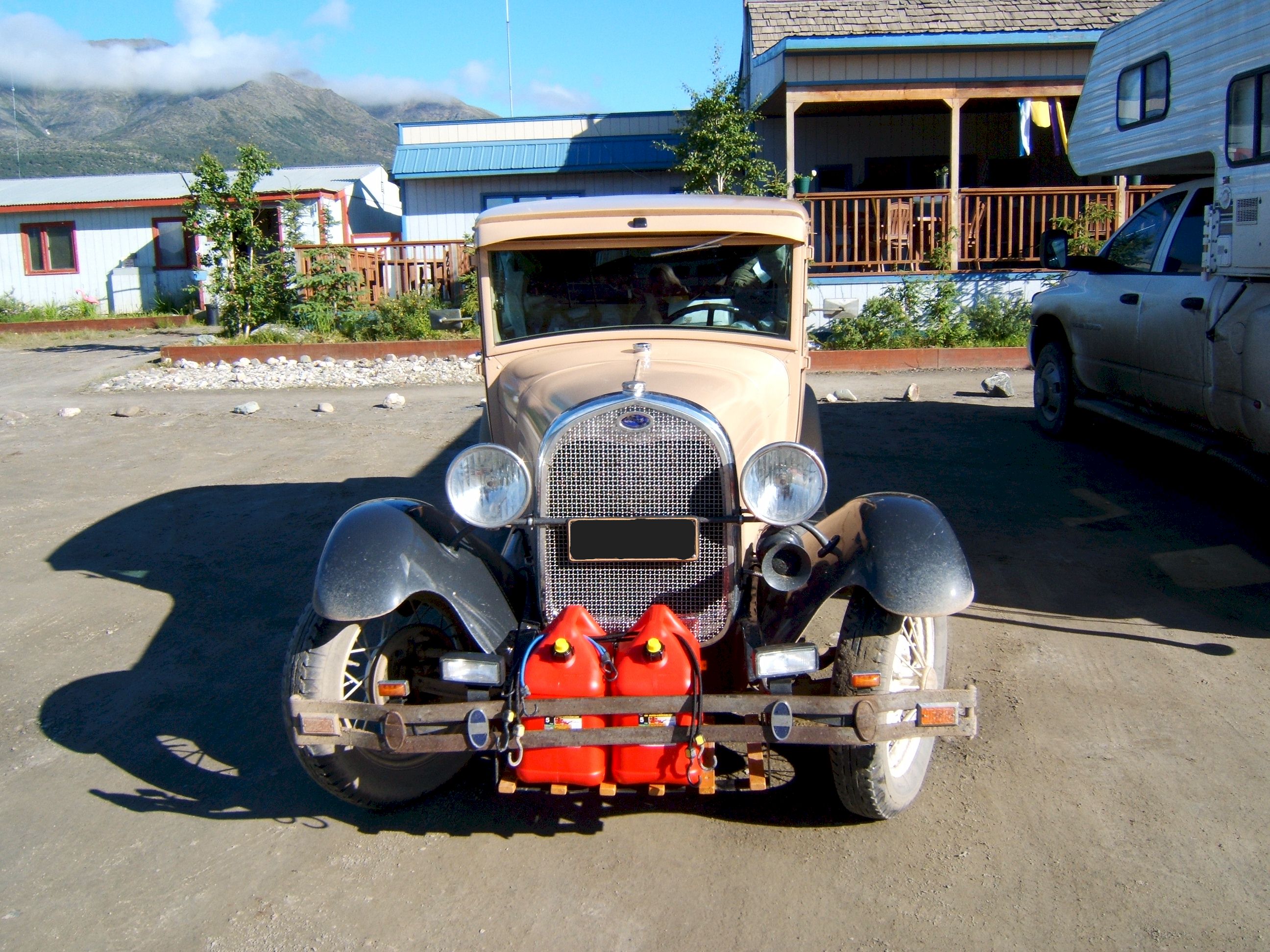
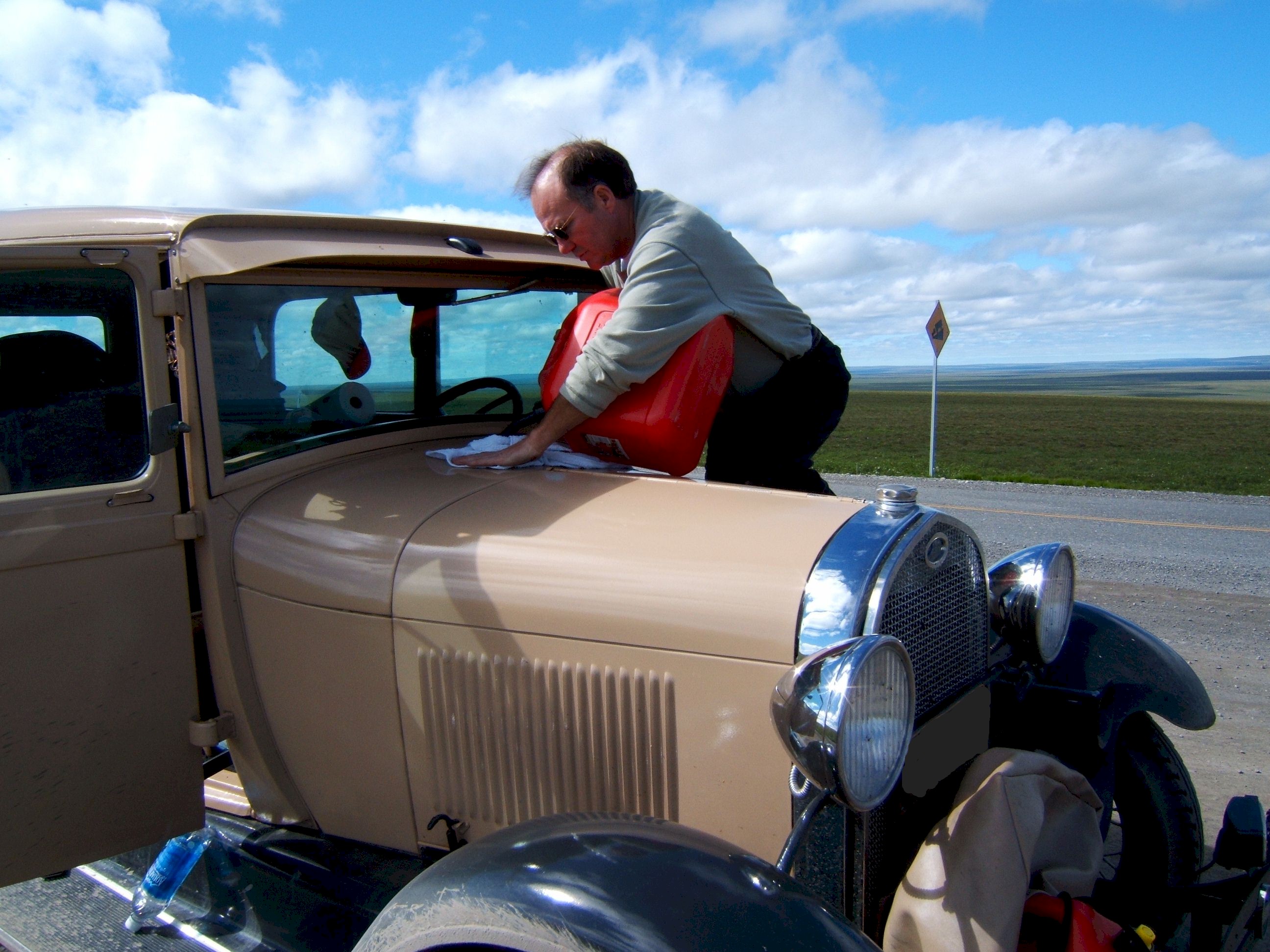
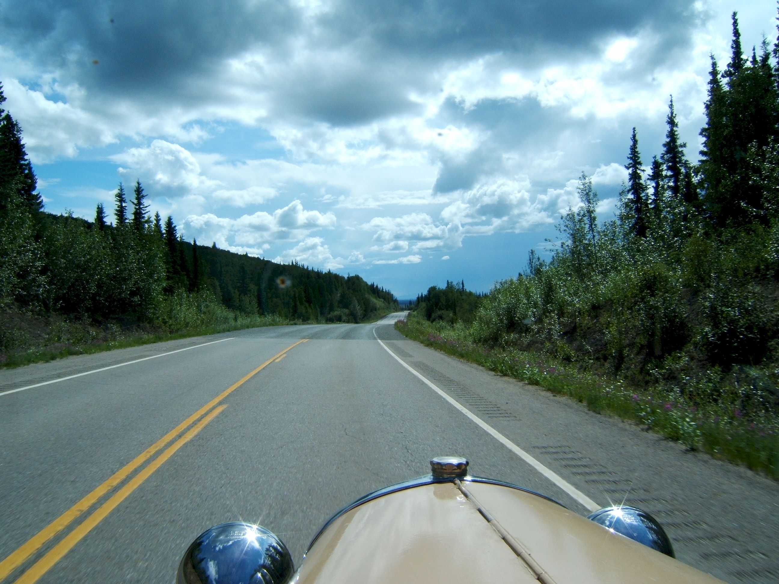
Monday July 3, we drove 238 miles from Cold Foot N67 15.064 W150 10.553 to Deadhorse N70 12.118 W148 27.919 The next gas was in Deadhorse which is about 240 miles away. My gas tank holds ten gallons and I get about eighteen mpg. This means I will run out of gas about sixty miles before I get to Deadhorse. I built the rack on the front of the car to carry tools or gas cans. I needed only one five gallon can to reach Deadhorse, but I brought along two, in case I found someone on the road out of gas, then I could help them.
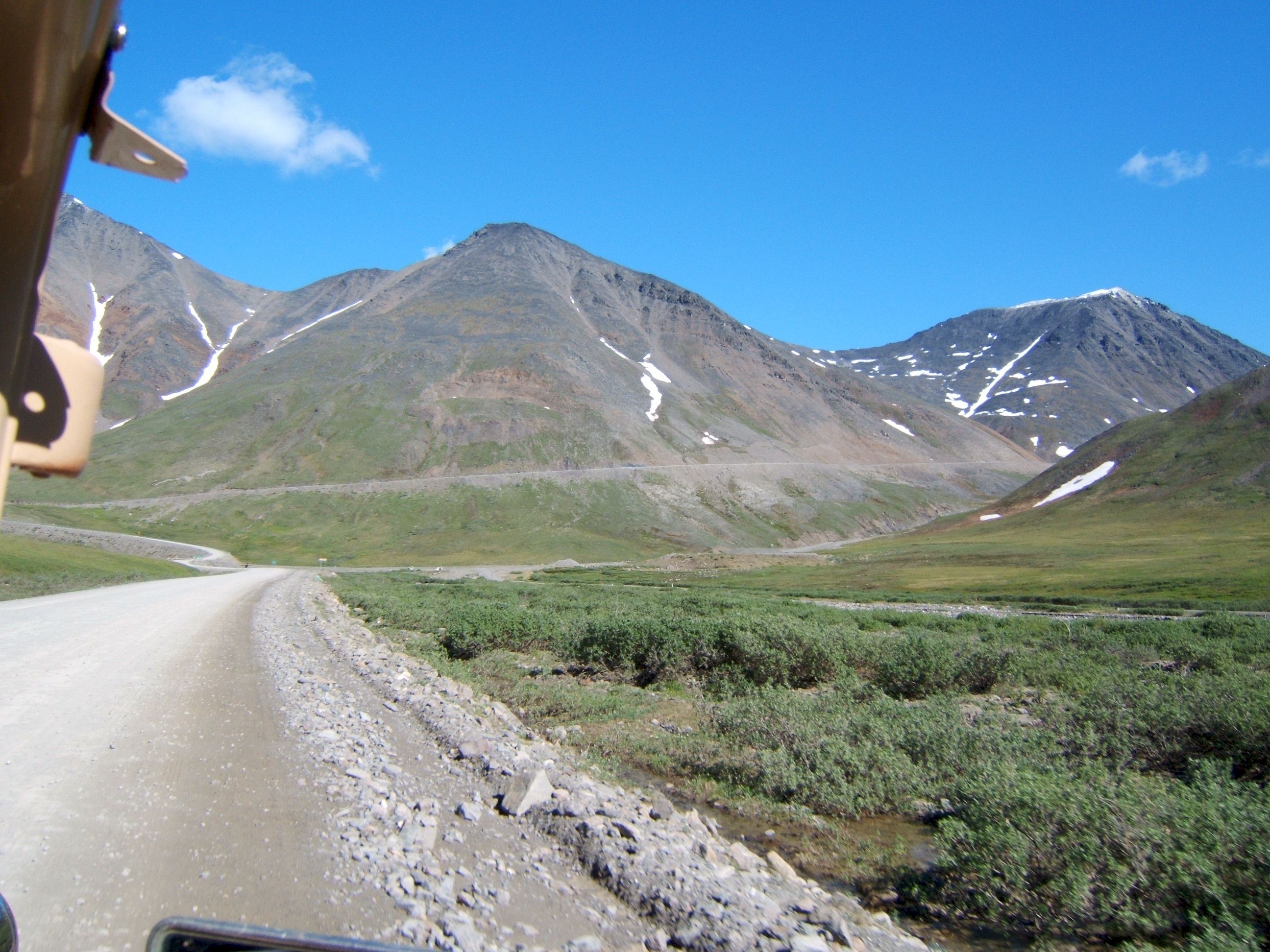
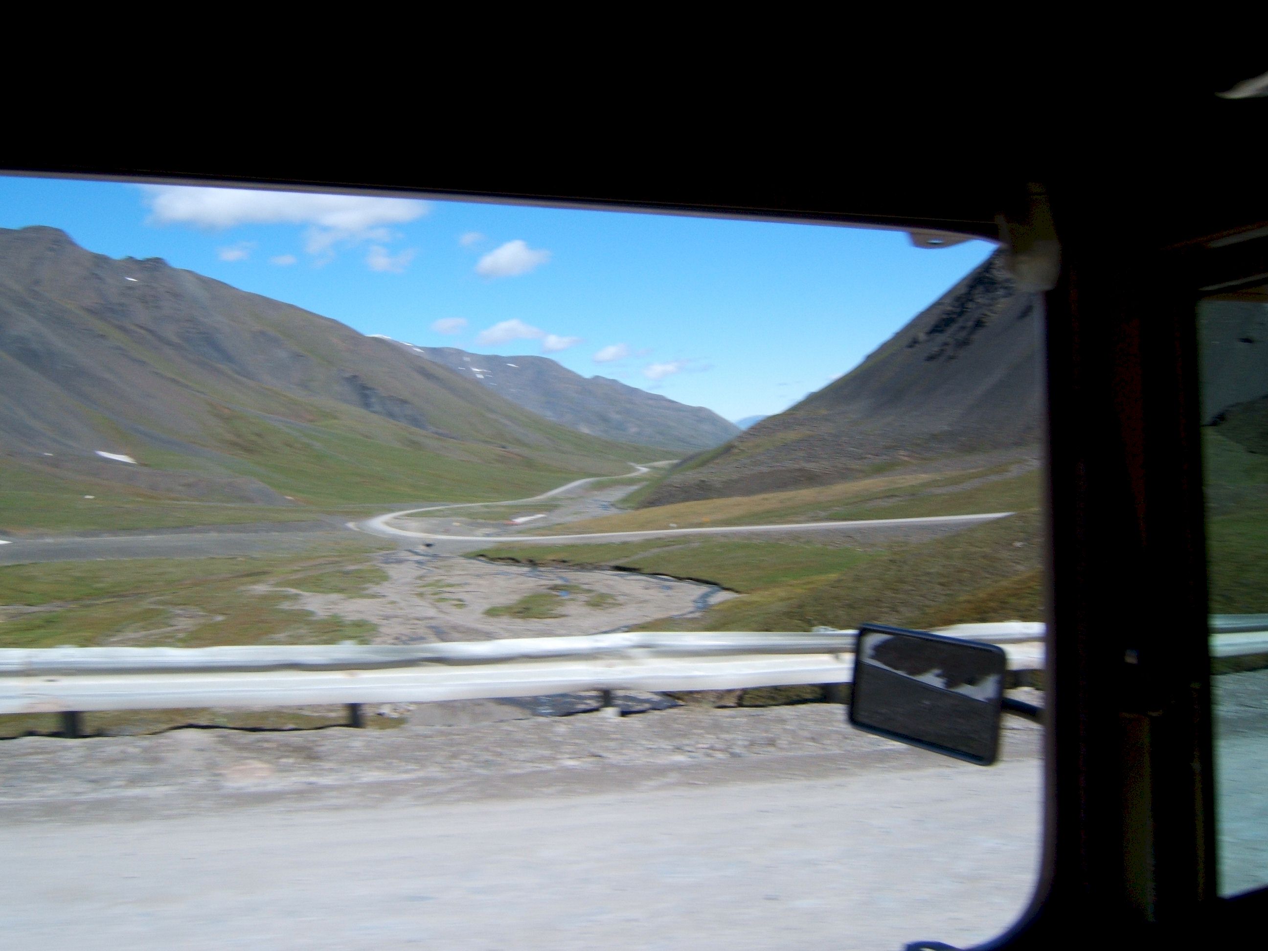
This is the beginning of the Brooks Range of Mountains, and Atigun Pass. Most people sounded alarmed when they learned we would be driving over Atigun Pass, but I did not find it particularly difficult. The pass is at an elevation of 4732 feet.
A view north from Atigun Pass, we are almost down the mountain. The north side is the steepest.
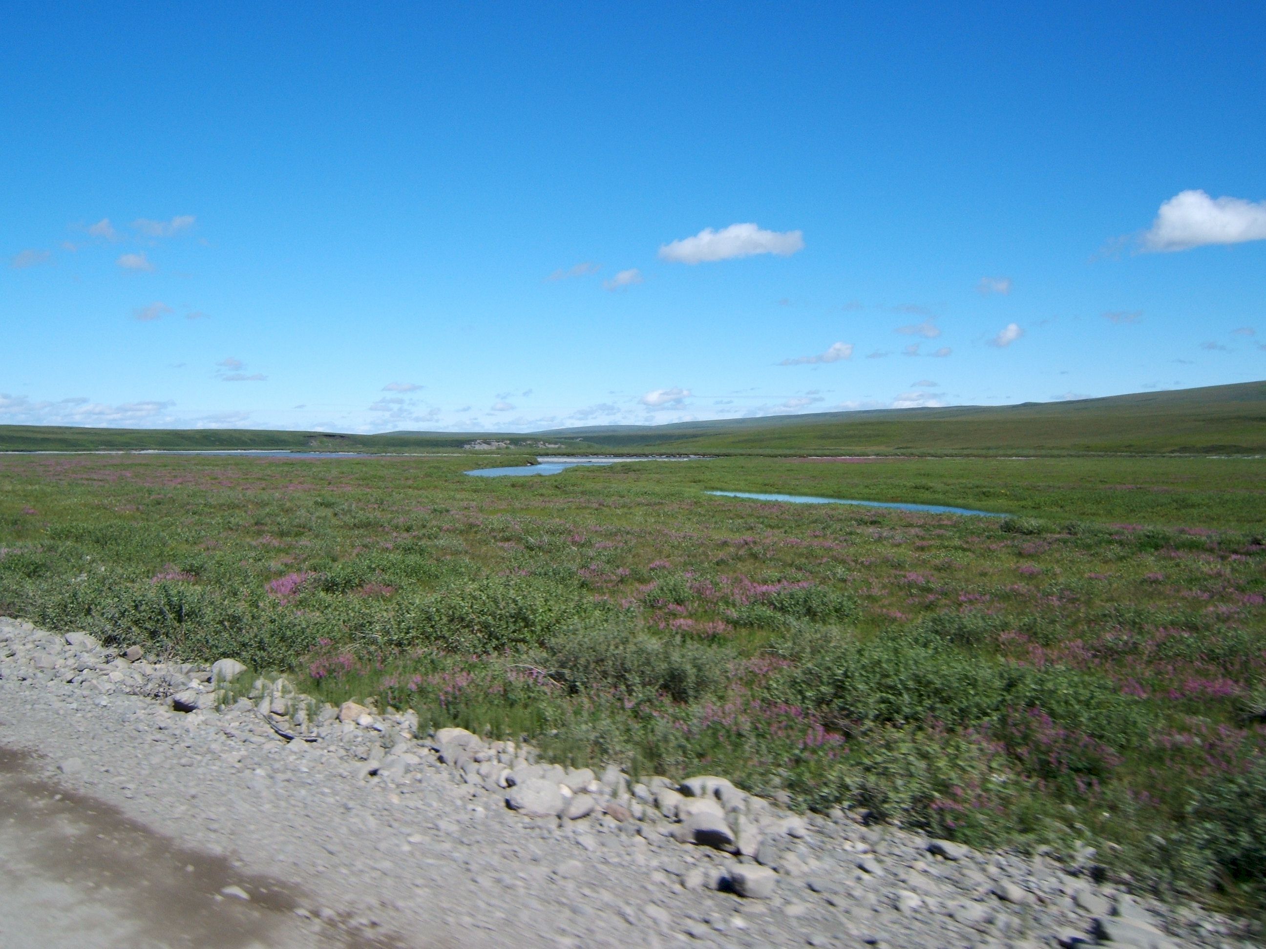
Here we are north of the arctic circle and there are pretty flowers everywhere.
Its time to fill up with the extra gas. I am not out yet, but this was a wide spot in the road and seemed a safe place to fill up. I put in one five gallon can. I have driven 179 miles from the last gas station in Coldfoot.
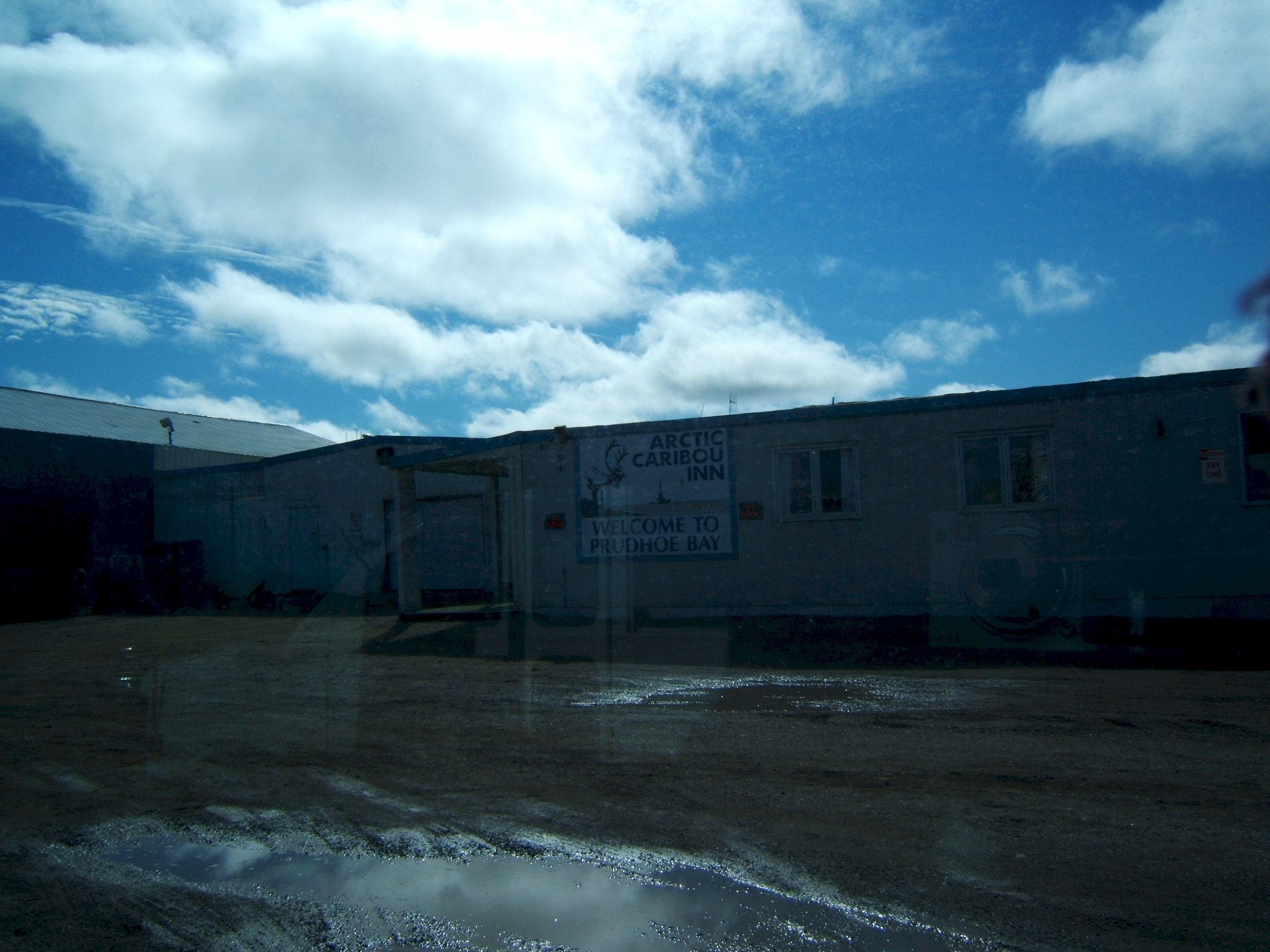
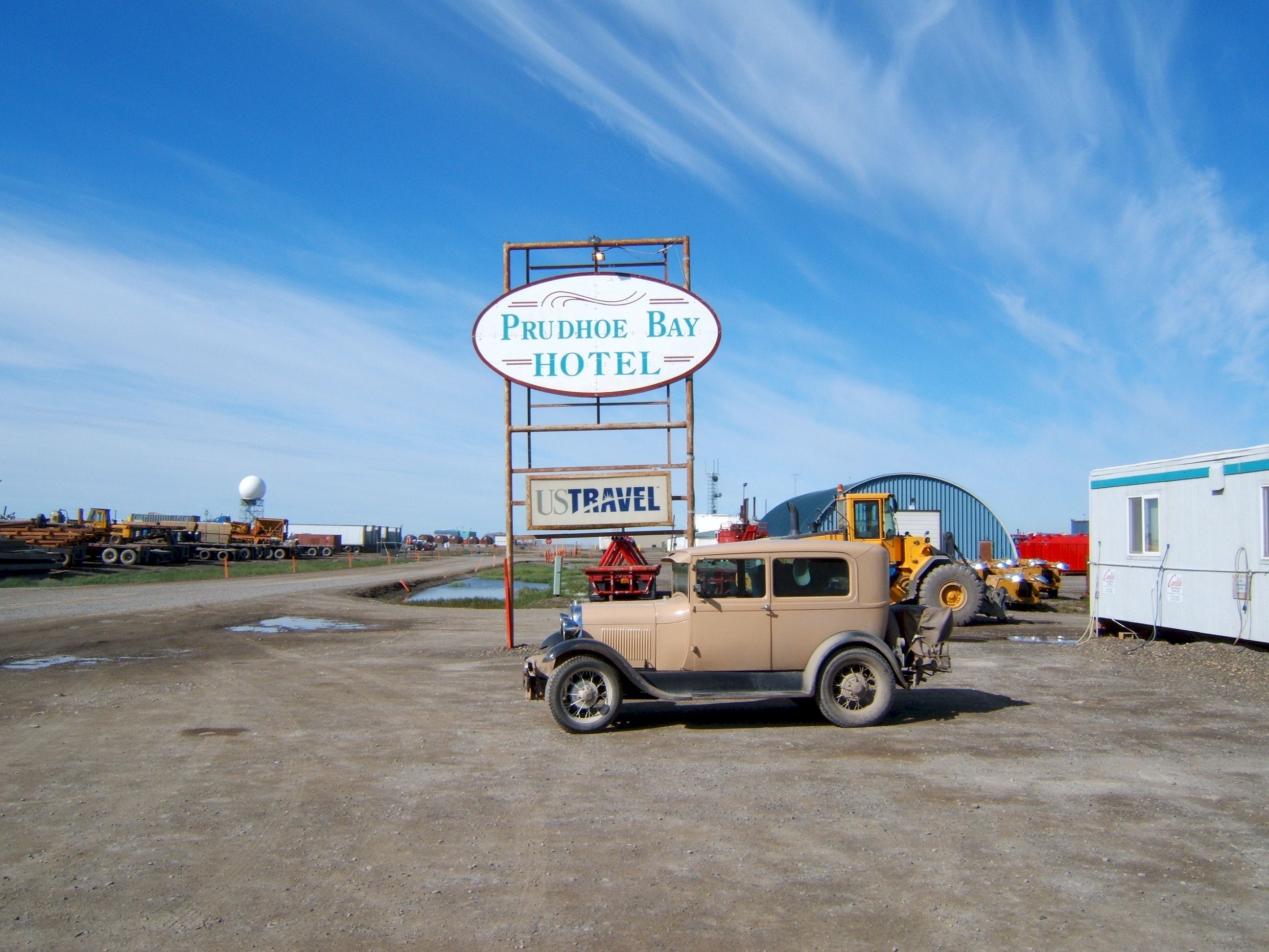
This picture was taken through the windshield and into the sun. It is of the Hotel we stayed in at Deadhorse, the Arctic Caribou Inn. We did not know the good Hotel is the Prudhoe Bay Hotel, just a half mile down the road. Patty did not eat here, I'll eat anything and had a huge meal. It was not that good. And the rooms were not well kept. I was told later that this Hotel is used when the other one is full.
Day 18
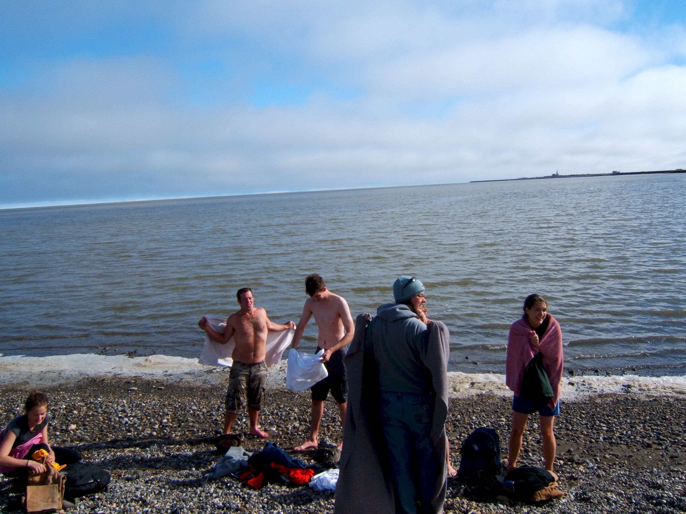
Tuesday, July 4th. We drove 232 miles from Deadhorse N70 12.118 W148 27.919 to Wiseman N67 24.584 W150 06.534 The oil company will not allow anyone to drive through the oil fields to the Arctic Ocean. To see the ocean we had to purchase an Arctic Ocean Tour pass and take a bus to see it. Patty and I had our jackets on because it was cold, then we saw some of our tour group had jumped into the water. If you swim in the Arctic Ocean, you can become a member of the polar bear club. Neither Patty or I thought that certificate was worth jumping in.
The Prudhoe Bay Hotel is where we should have stayed it is nice with full amenities. We stayed at the other Hotel because that is where the tour bus to the Ocean left from.
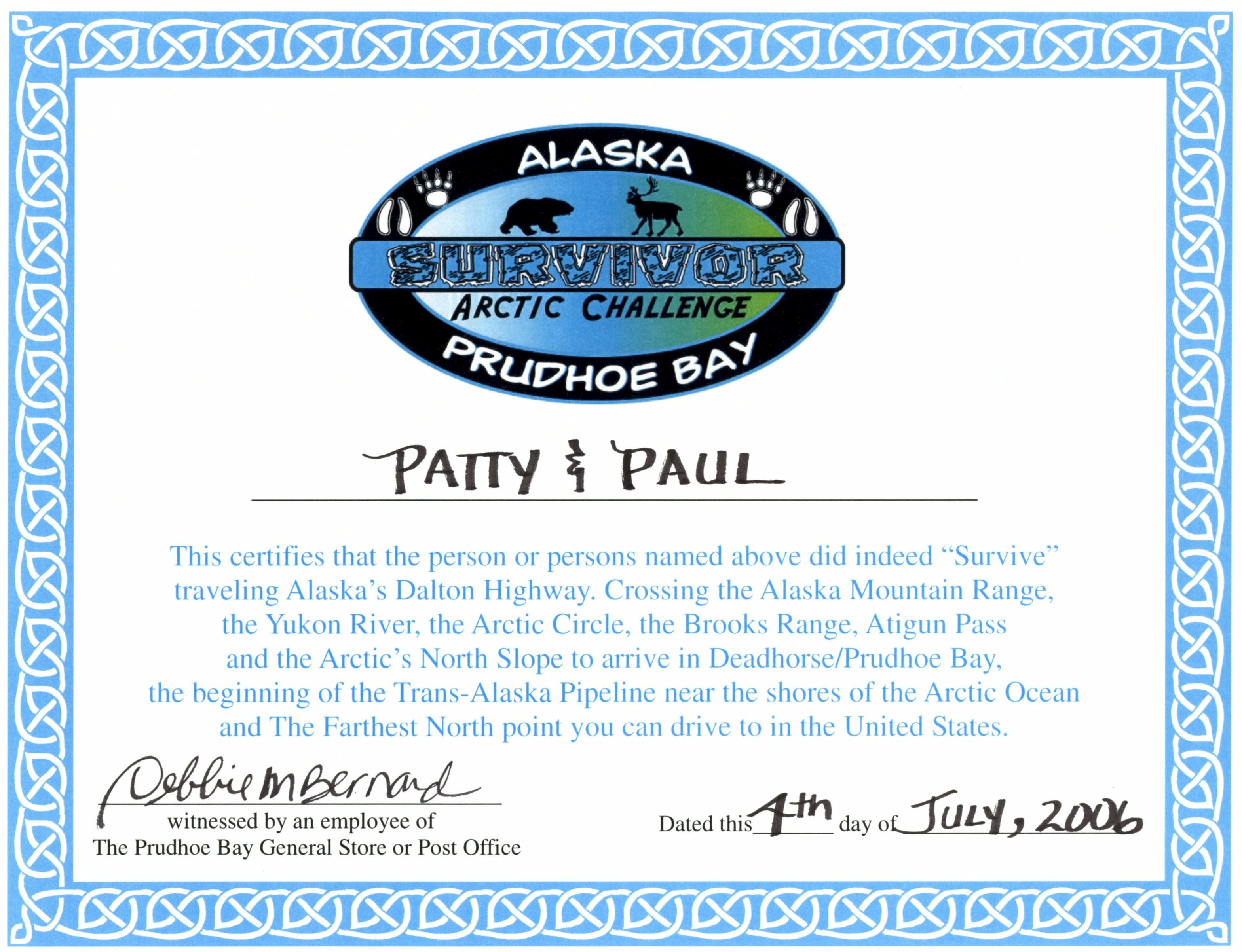
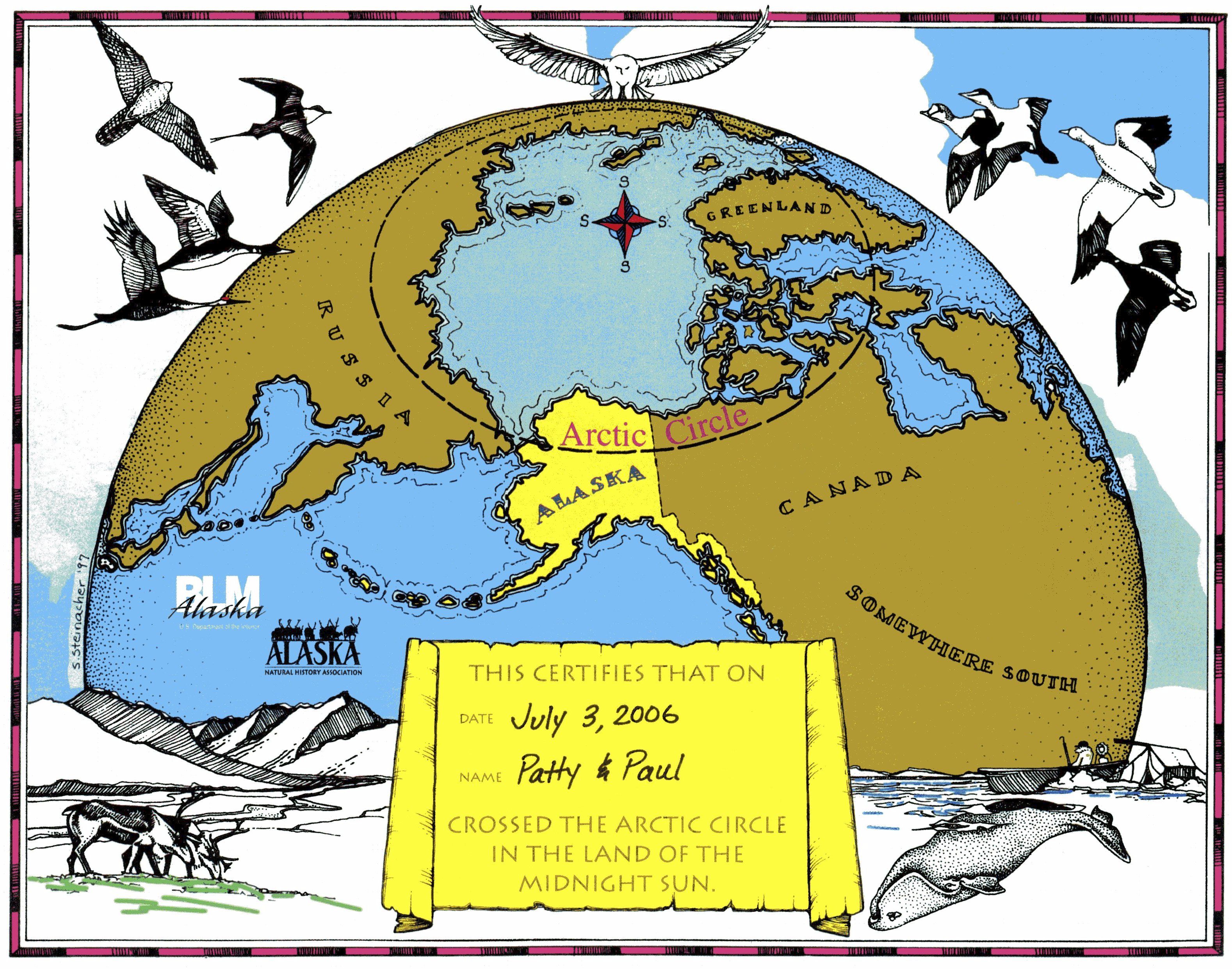
We got this certificate at the General Store.
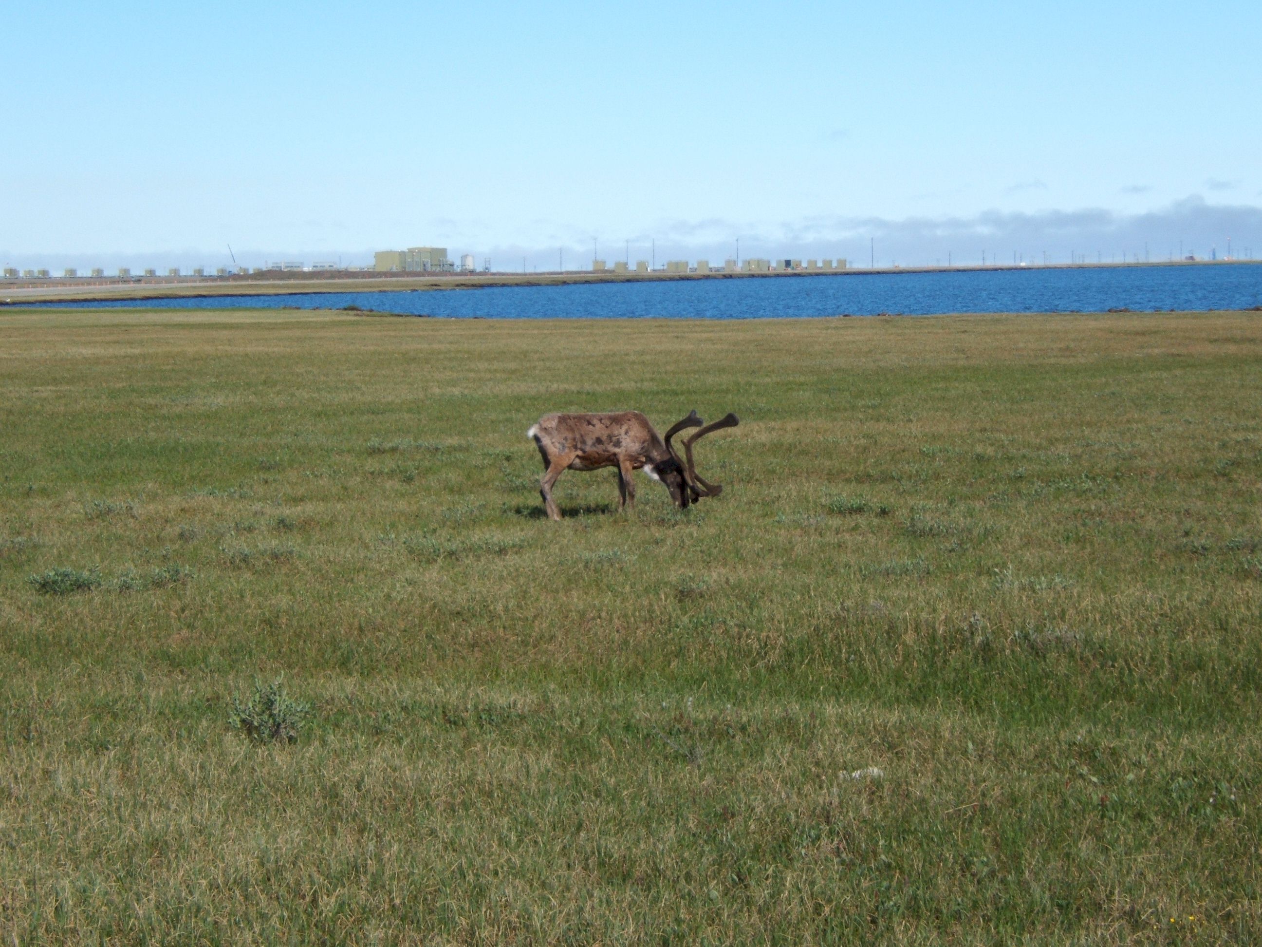
This Caribou was grazing between the road and the lake. The fact that people and machines were working in the area did not see to disturb him.
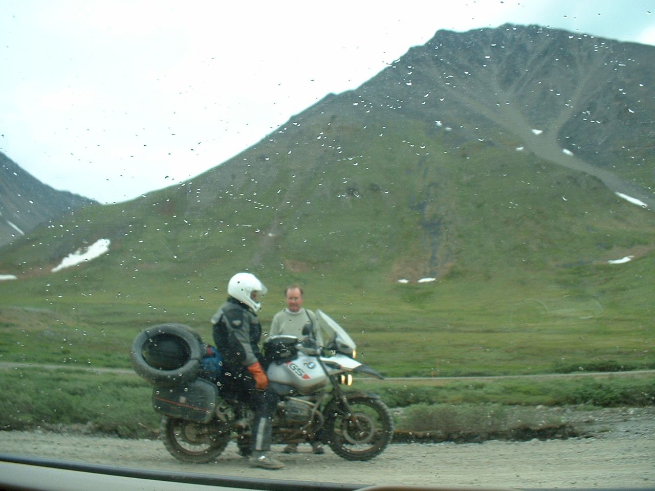
When I stopped to put my extra gas in on the way back south, this guy on the bike stopped to see if we need any help, he is an Alaska Road Dept. employee, heading to Fairbanks for his days off. Notice the two extra tires he is carrying. It is recommended to carry spares, we did carry the regular one, but did not need it.
This is the cabin we stayed in at Wiseman, there were three bedrooms, another family had the other two. It was comfortable. Everything runs on twelve volts. They have solar panels and a wind generator to charge the batteries.
Day 19
Wednesday July 5, we drove 268 miles from Wiseman N67 24.584 W150 06.534 to Fairbanks N64 50.131 W147 49.390 If I had not been here I would not believe that this picture was taken north of the Arctic Circle. This is a very pretty area. The weather is like northern Minnesota.
We stopped at the visitors center in Coldfoot on the way back. This certificate was a nice souvenir, But it was a long drive just to get it.
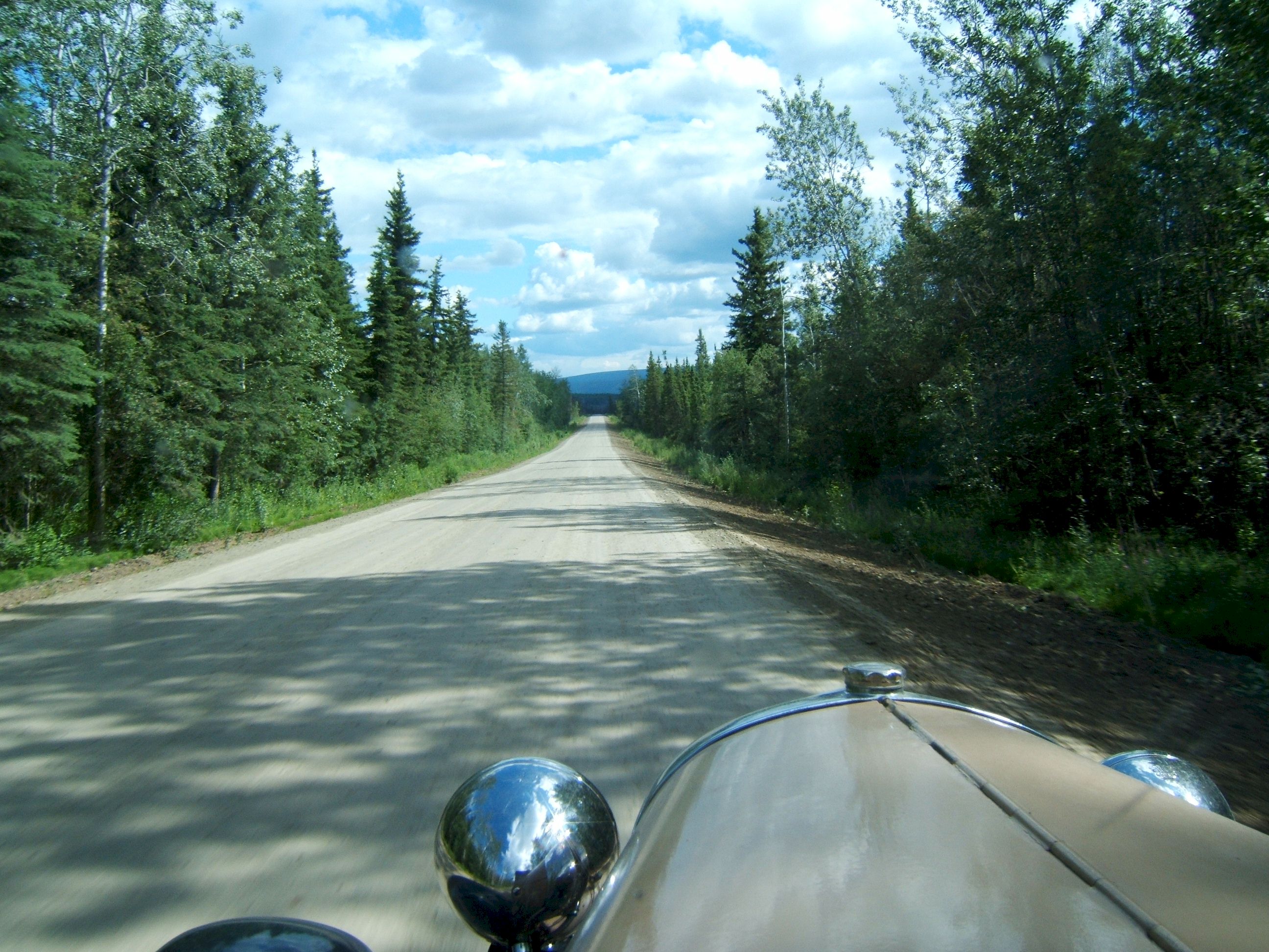
A straight stretch of road through the trees.
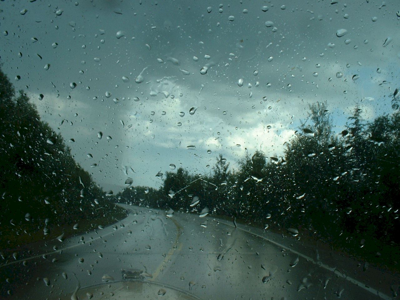
This was a hard rain but soon ended. I am glad we made it to pavement. Maybe the rain will help clean the car off.
When we arrived back in Fairbanks we got a Motel room near the airport. It was the cheapest nice room we could find.
Day 20
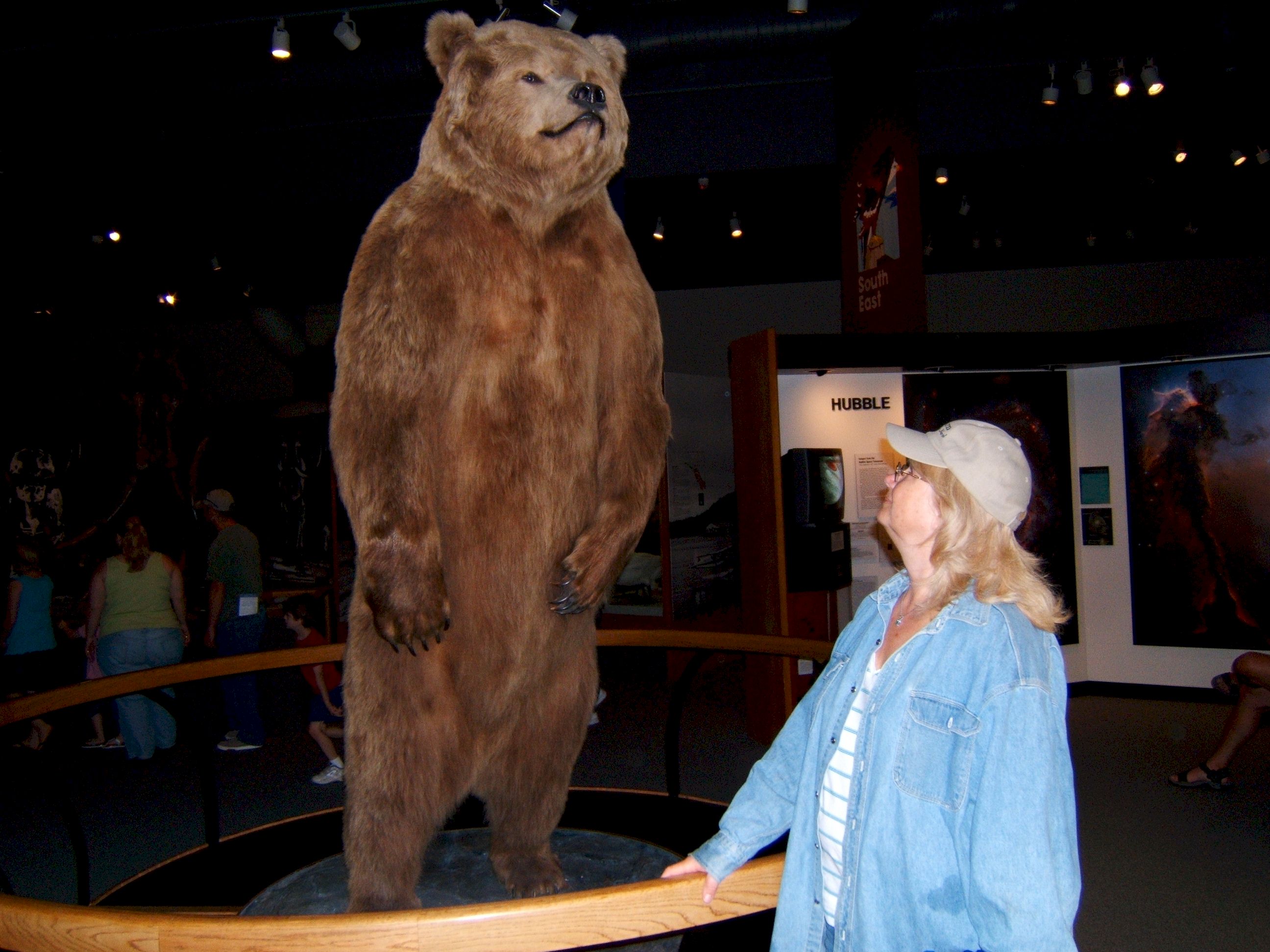
Thursday July 6, we drove about 27 miles around Fairbanks N64 50.131 W147 49.390 Patty meets a bear, and is not afraid this time. This is at the Museum at the University of Alaska at Fairbanks. .
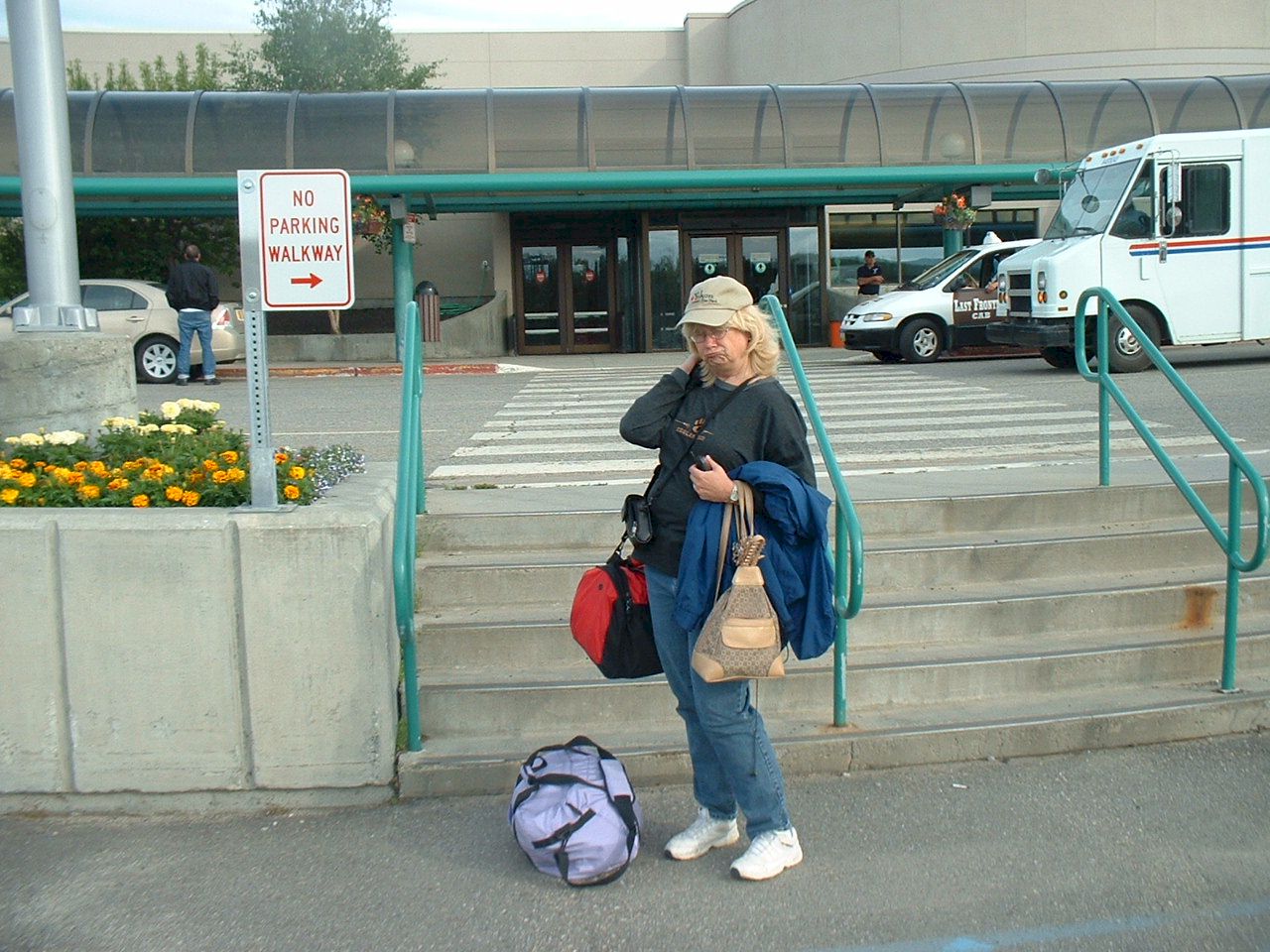
Patty needed to get back to work and could not drive home with me. She took Alaska Airlines back to San Diego.
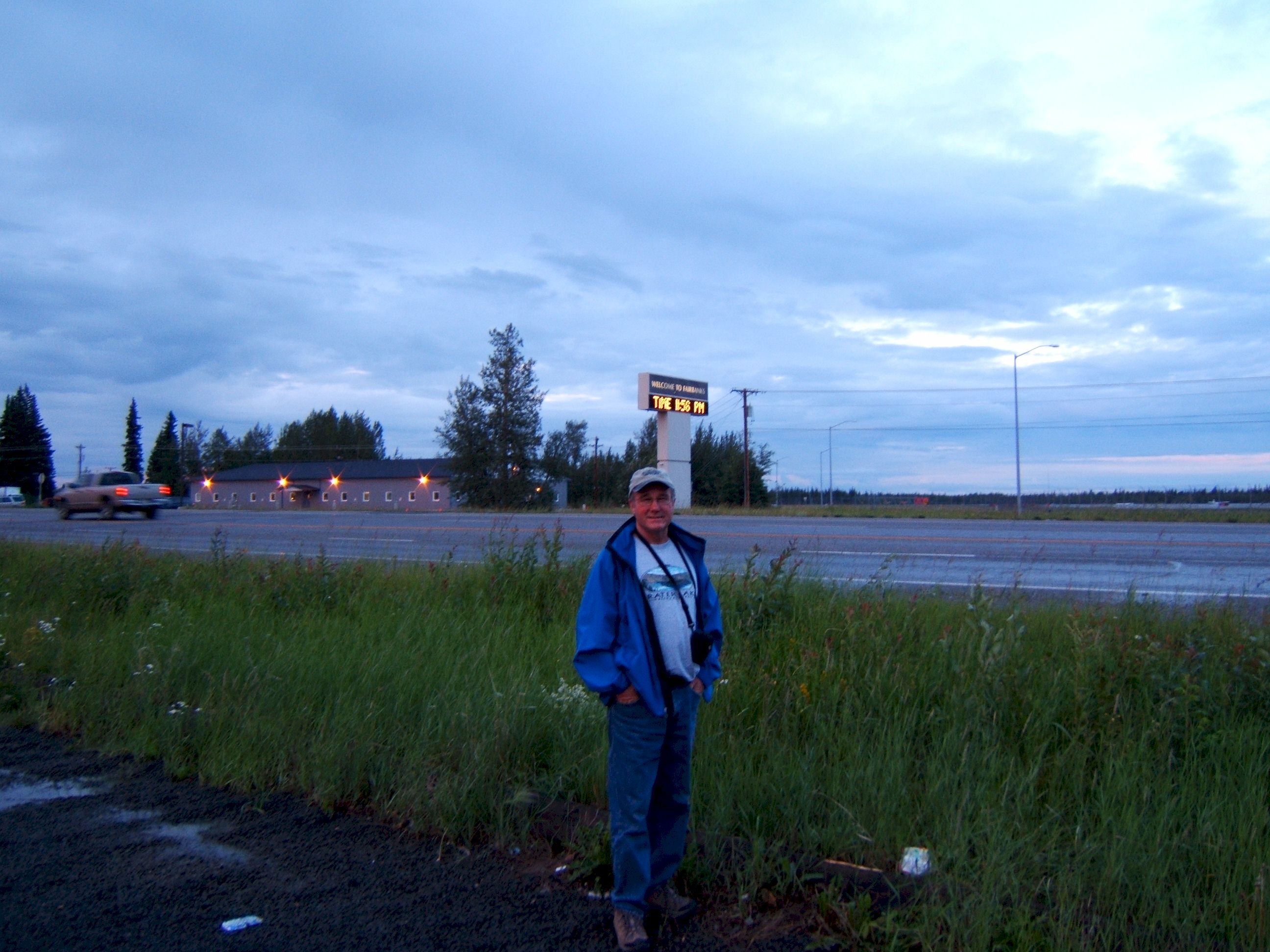
Fairbanks in the midnight sun. It was not as bright as Deadhorse at midnight, but still light enough to see.
Day 21
Friday July 7, I drove 595 miles from Fairbanks, Alaska N64 50.131 W147 49.387 to Whitehorse, Yukon N60 40.985 W135 03.564 The weather forecast from Fairbanks on July 6th, was for a week of rain across Alaska and Northern Canada. I saw no reason to stay in a $150.00 a day motel room waiting out the rain, so I headed south. Prior to this the weather was near perfect, clear sky and warm most of the time, with just a few showers. I arrived in Whitehorse in the late evening and put up my tent at an RV park.
Day 22
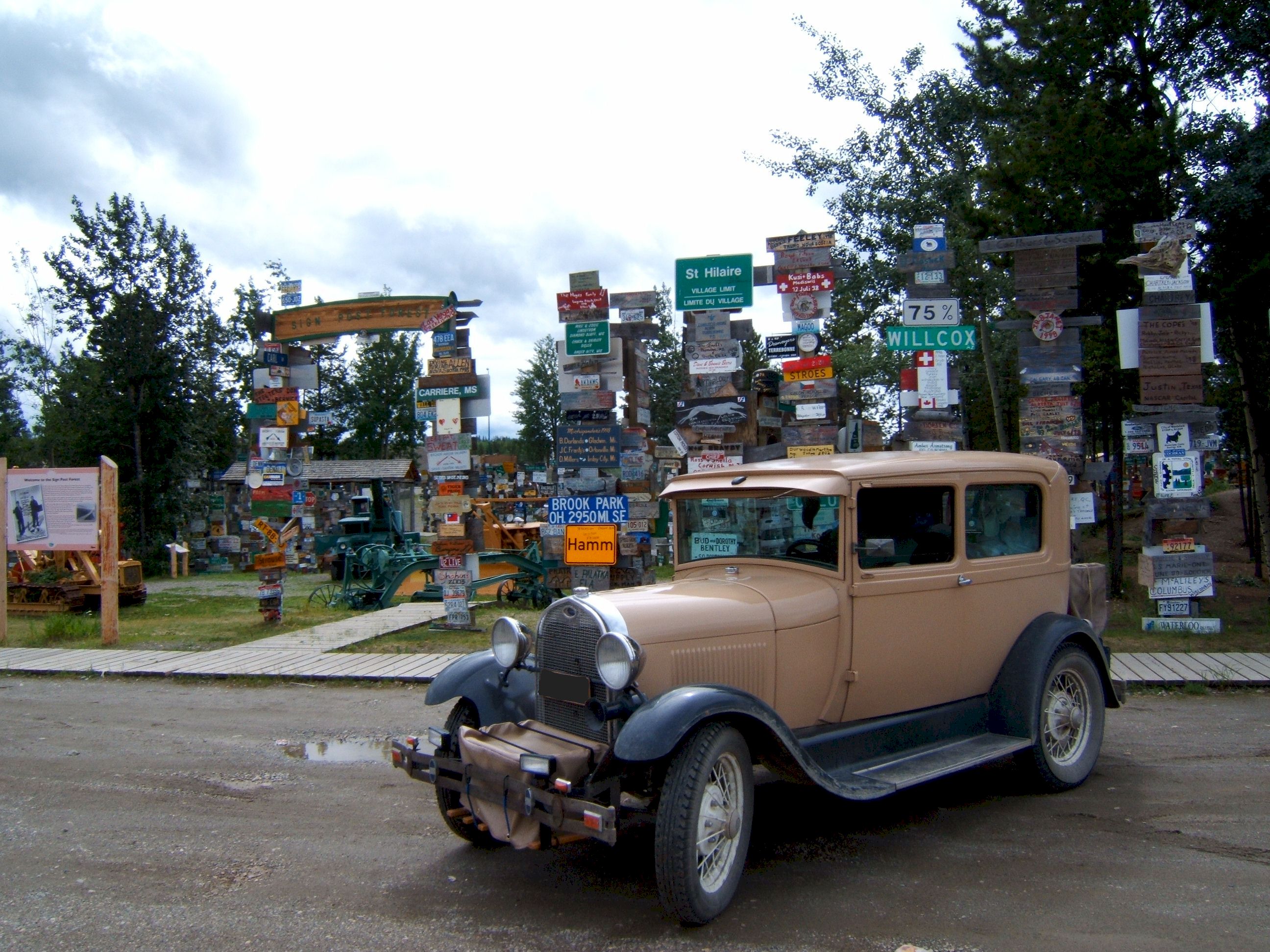
Saturday July 8, I drove 592 miles from Whitehorse, Yukon N60 40.985 W135 03.564 to Ft. Nelson, British Columbia N58 48.152 W122 41.161 I stopped at Watson Lake to get a picture of their famous sign post forest. This will be another long day, I arrived in Ft. Nelson about 10:00pm and got a Motel room for the night.
|